Colorado River and Fire Mountain
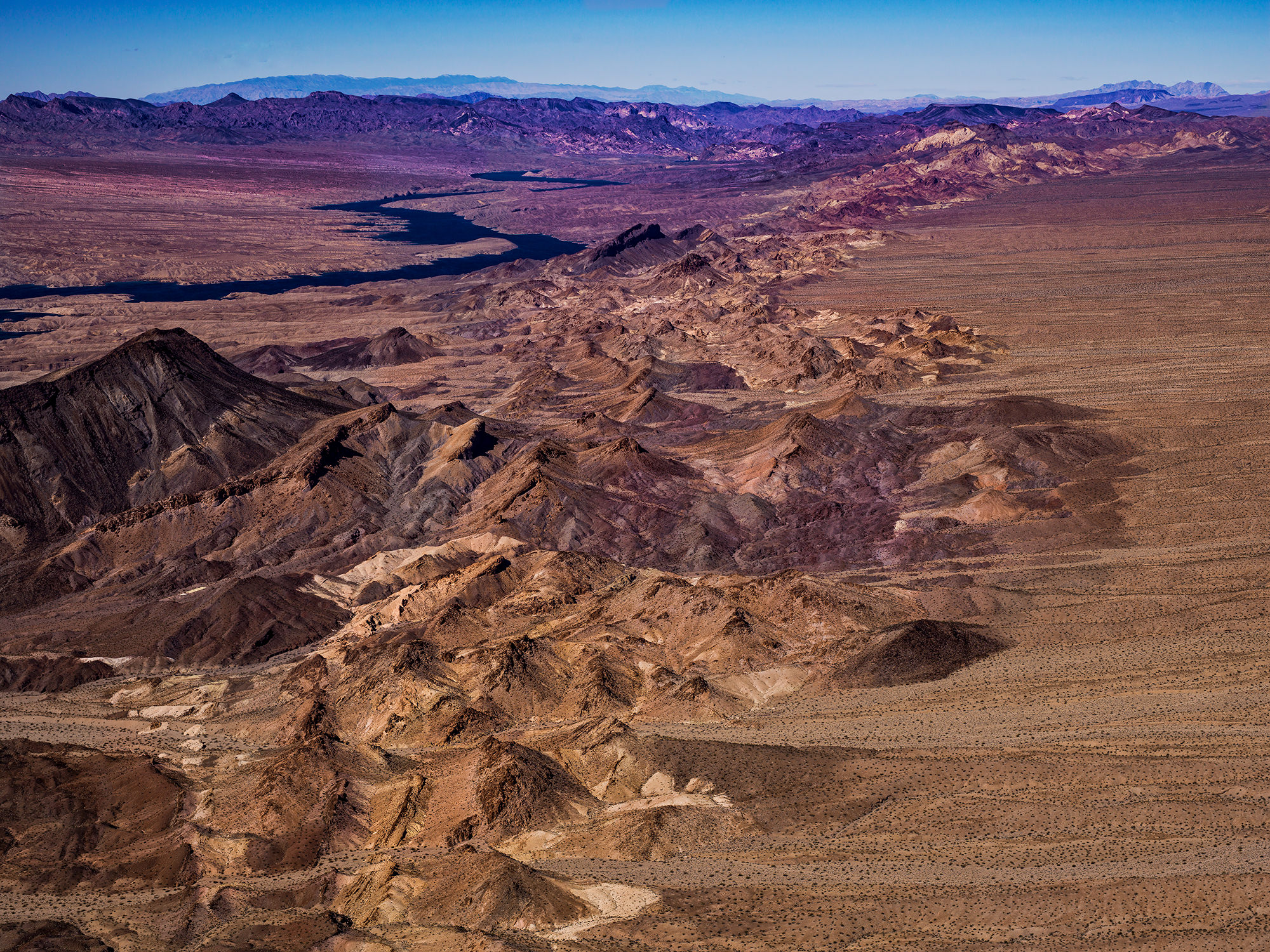
This is the Colorado River as it snakes past Fire Mountain in the Mojave Desert on the Arizona / Nevada border. Taken early in the morning from an altitude of 1,200 feet (365m) above ground, this image below is the Colorado River south of Boulder City, Nevada. To the left is west and those are the El Dorado Mountains along the horizon.
This area is known as Black Canyon and was formed about 15 million years ago during the Miocene Basin and Range uplift. Black Canyon gets its name from the black volcanic rocks that are found throughout the area. On the right side of the river lays Fire Mountain, Malpais Flattop Mesa, and the Black Mountains on the Colorado River. This very clear faulted ridge-line runs alongside the Colorado River, forming the border between Nevada and Arizona.
For the full story on this image visit the corresponding page on Where Eagles Fly
Available in 2 sizes;
- 14″ x 18″
- 18″ x 24″
- 27″ x 36″
- 34″ x 46″
Available on 5 types of print media;
- Fujiflex Crystal Archive paper
- Fujiflex Crystal Archive paper mounted in acrylic
- Satin Metal
- Aluminum
- Giclée Canvas
Archival Paper and Giclée Canvas prints are shipped in a rolled tube and ready for framing or stretching (for canvas).
Acrylic, Satin Metal, Aluminum, and Giclée Canvas Prints are available either ready to hang or without any mounting or hanging hardware.
Contact Zedekiah Gallery for information or to place an order.